Manage flights easily & create briefings
View flight schedules & delay awareness
Airfield monitoring of WX & NOTAM data
Real-time NOTAM alerts and filtering
Global awareness of aircraft position data
Digital manuals direct to the flight crew
Single point of truth for post-flight analysis
Access historic flight data storage
Streamline flight deck with an integrated EFB
Real-time data for accurate briefings
Improve flight phase data capture
Create digital forms for flight crew
Access to detailed weather & route data
Capture safety reports via the journey log
Weight and Balance for accurate & efficient pilot calculations
Switch to digital with EFB or PDF briefing
Identify METAR & TAF trends for improved flight planning
Generate pre-flight briefing packs & release to the pilots EFB
Weather charts within briefing packs
Generate custom ETOPS charts
Distribute notices to briefing packs
Generate custom briefing packs
Precise Weather & NOTAM for airfields, using operational data.
Integrating data across all flight phases
Upcoming features planned for skybook
Read the latest updates and features
View skybook’s live uptime status
Training and 24/7 support service
Join the next webinar and watch our videos
Frequently asked questions about skybook
Latest company and product news
We have evolved into true aviation experts
Optimising air travel around the world
Interested in joining our team at Bytron?
A united team is vital to our success
A selection of valued customer case studies
Let’s help you improve safety & efficiency
ABOUT SKYBOOK Request Demo
Planning Portal provides detailed briefing information for an improved flight planning process.
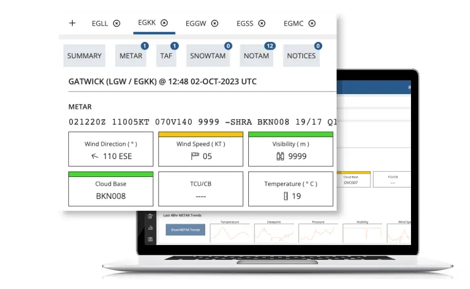
Create groups of airports that are relevant to your routes using ICAO or IATA codes.
Instantly gain full awareness of METAR, TAF, Wx trends and NOTAM data for all your airports at once.
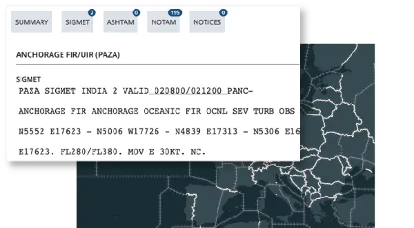
Access detailed Wx information for all of your flight information regions of interest.
This also includes data for ASHTAM, NOTAM and any vital operational notices that have been added to that FIR.
SEE OPERATIONAL NOTICES
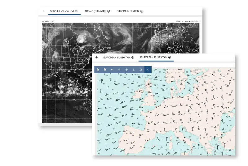
Save time flight planning by accessing the latest region satellites, infrared images and weather charts.
View a range of Wx charts that show upper wind and temperature for ICAO regions; and different flight levels for current times, or 6 to 12 hours from now.
SEE BRIEFING CHARTS
Get access to our latest news & skybook updates