Read-only vs data-driven EFFs in aviation
In this article, we delve into predictive contrail data and how skybook leverages it to enhance route charts for improved situational awareness for pilots and flight planners during digital briefings.
Predictive contrail data is an emerging innovation in aviation that forecasts and help mitigate contrails; those long, thin clouds formed by aircraft at high altitudes.
Using advanced machine learning algorithms and weather data to provide accurate predictions about where and when contrails are likely to form along a flight route.
Future regulations could require airlines to quantify and report non-carbon emissions, which includes contrails.
Carbon Offset and Reduction
Existing schemes like CORSIA (Carbon Offsetting and Reduction Scheme for International Aviation) may evolve to account for non-CO2 climate impacts, including contrails.
Emission-Based Charges
Future regulations could introduce fees for flights that produce significant contrail warming, incentivizing airlines to avoid contrail-heavy areas.
Environmental Reporting
Airlines may be required to report contrail-related data as part of sustainability disclosures.
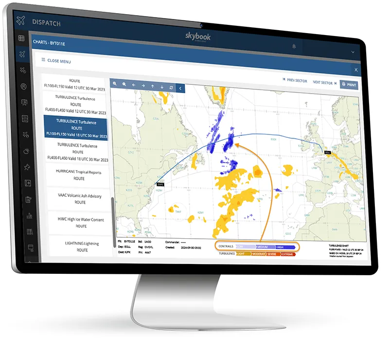
Leveraging contrail API datasets, skybook is at the forefront of helping airlines mitigate contrail warming by visually presenting key contrail data, enabling informed route adjustments and potentially avoiding future emission charges.

Environmental Impact
Persistent contrails can evolve into cirrus-like clouds that trap heat in the atmosphere. Adjusting flight paths can reduce that chances of contrail formation and lower an airline's climate impact, aligning with regulatory requirements
High Accuracy Forecasting
AI models analyse real-time meteorological data, such as temperature, humidity, and wind conditions, to predict contrail formation zones with high accuracy.
Route Optimisation
Predictive contrail data can be integrated into flight planning tools, enabling airlines to select routes that avoid contrail-heavy areas without significantly increasing fuel consumption or flight times.
Enhanced Visual Data
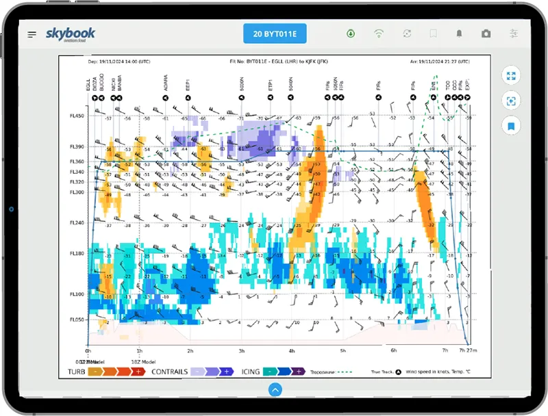
Pilots and flight planners can visualise contrail risks on briefing charts, such as vertical profile displays and lateral turbulence charts, making it easier to adjust operations proactively.
Integration with Other Data Sets
Often paired with turbulence, icing, or other weather-related forecasts to provide a comprehensive view of atmospheric conditions.
Passenger Experience
Indirectly enhances passenger comfort by avoiding turbulence heavy routes, often associated with certain atmospheric layers.
While regulations are still in development in regard to contrails, the industry is proactively addressing the issue through technology, operational practices and sustainability initiatives.
Solutions like the skybook EFB & Ground Portal are making use of predictive contrail data so pilots and dispatchers are more aware, and airlines can prepare for a more environmentally conscious future.
If you would like to try skybook within your operations, be sure to get in touch.