
ATIS & ATC Clearance on EFB

Pilots need a clear understanding of their flight path before take-off, and Vertical Profile Charts provide this.
By incorporating these charts into pilot briefings, flight crews can make more informed decisions, anticipate challenges and ensure a smoother, safer journey.
Let's explore what they are and how they enhance flight briefings...
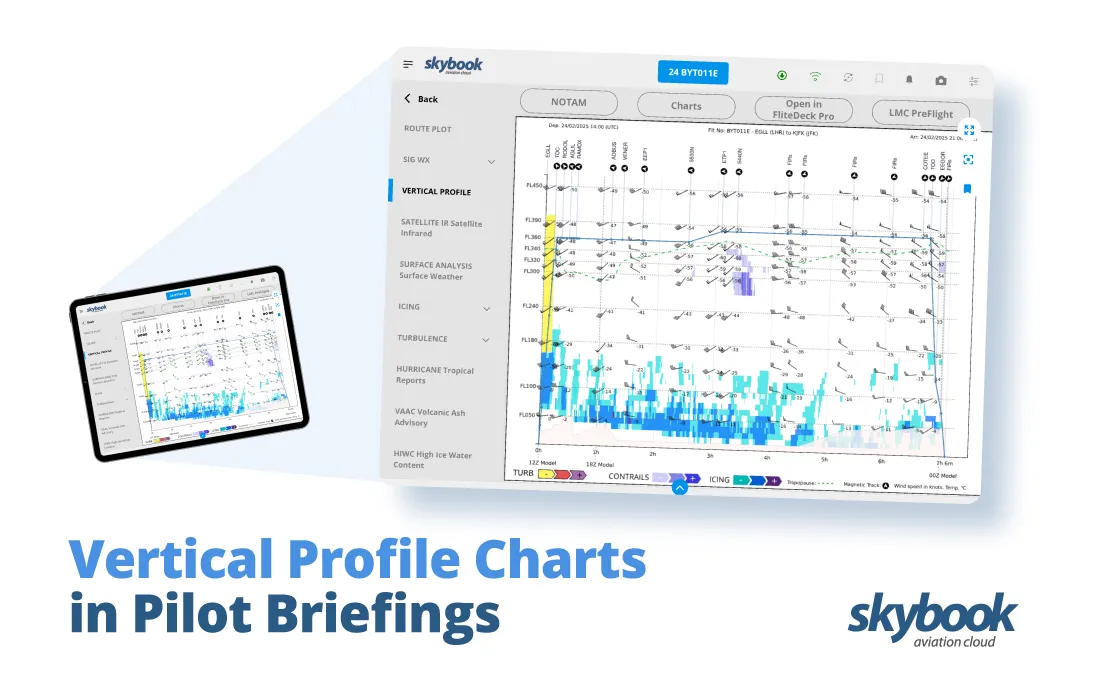
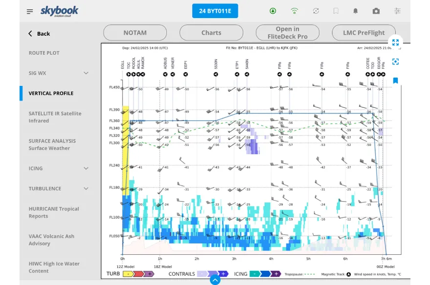
A Vertical Profile Chart is a graphical representation of an aircraft’s flight path in relation to altitude, terrain, weather, and airspace constraints. (Also known as a vertical cross section chart)
It provides a side-on view of the planned route, helping pilots visualise altitude changes, potential hazards, and key flight parameters in a way that a standard route plot cannot.
These briefing charts are particularly useful in pre-flight briefings, offering critical insights into:
By presenting this data visually, pilots can make better-informed decisions, anticipate challenges, and ensure compliance with airspace regulations.
Before take-off, pilots conduct thorough briefings to assess potential risks and refine their flight strategy. Vertical Profile Charts play a vital role in this process by providing:
1. Enhanced Situational Awareness
Pilots can quickly interpret altitude restrictions, terrain obstacles, and possible airspace conflicts along their route.
2. Weather Insights
Seeing weather conditions such as jet streams, turbulence, or storm cells in a vertical format allows pilots to plan alternate altitudes if needed.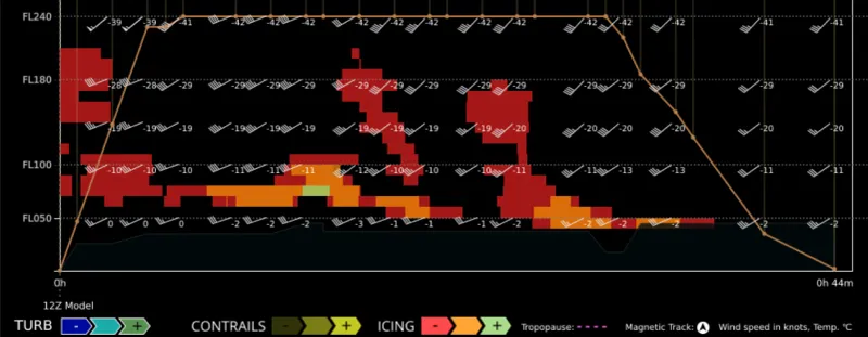
3. Optimized Flight Planning
Understanding the climb and descent gradients aids in fuel efficiency and smooth flight transitions.
4. Regulatory Compliance
Ensures pilots remain within required altitude constraints and airspace clearances.
Our advanced vertical profile charts on the skybook Electronic Flight Bag (EFB) take pilot briefings to the next level, by integrating real-time and forecasted flight data into a clear, interactive format.
Pilots can seamlessly access crucial flight data; here’s how skybook enhances the experience:
Automated data integration
Flight plans, weather updates, and terrain data are automatically included, reducing manual input and potential errors.
Live weather overlays
Real-time turbulence, predictive contrails, icing risks, and storm activity are displayed, allowing pilots to make proactive route adjustments.
Customisable views
Pilots can toggle between a variety of charts, focusing on what matters most for their specific route.
Airspace Awareness
Helps pilots identify controlled and restricted zones well in advance, ensuring compliance with aviation regulations.
Dispatch & flight planning
Dispatchers and flight planners can also access all charts, enhancing support and situational awareness throughout their workflow.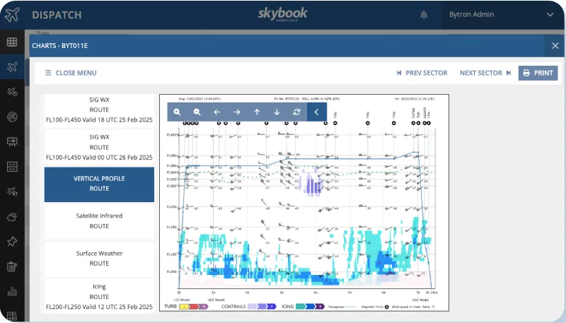
Vertical profile charts are a crucial tool for pilots, improving situational awareness and decision-making during flight planning.
Using these advanced charts enhances pilot briefings by providing a seamless, data-driven approach to understanding altitude, weather, and airspace interactions. Leading to safer and more efficient operations.
Are you ready to elevate your flight crew with skybook?


